See the Storm Surge in Real-Time
In a landfalling tropical cyclone, the wind pushes huge amounts of water onto shore. This storm surge often poses the greatest danger to human life since the rise of water can be as rapid as several feet in just a few minutes.
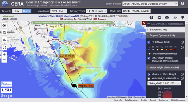
Hurricane forecasts typically focus on a storm’s track and maximum wind speeds. That’s why we use ADCIRC, a computer model with a 25 year track record of success, to calculate the storm surge corresponding to the latest official hurricane forecast track. We have also developed a software package (ADCIRC Surge Guidance System – ASGS) that we use on high performance computers to recalculate and update these ADCIRC projections every time a new forecast advisory is issued. And finally, we show the storm surge maps on an interactive web mapper (Coastal Emergency Risks Assessment – CERA) to help our users understand the potential impacts and timing of storm surge. This provides more information to decision makers and first responders to support their due diligence efforts to achieve better outcomes.