During a critical event like an impending or active tropical storm, emergency managers, weather forecasters, and GIS specialists seek visualizations and geographic data to evaluate the impact of this storm. The most sought-after information comes both from real-time measurements like water level stations and from coastal and ocean models that predict the tide, wind-wave, and hurricane storm surge conditions.
We provide real time decision support services based on a powerful system that works with three components:
- The ADCIRC storm surge model
- The ADCIRC Surge Guidance System (ASGS)
- The Coastal Emergency Risks Assessment (CERA) visualization tool

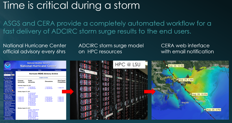
The ADCIRC storm surge model is a hydrodynamic simulation model developed for the purpose of predicting flooding impacts from ongoing and potential future storm events. ADCIRC is one of the most sophisticated models to compute tide, winds and hurricane storm surge. The model has seen many improvements in recent years, and its use is increasing. Our team ensures that ADCIRC’s leading storm surge modeling technology is available to all agencies charged with the mission of protecting life and property from coastal hazards.
The ADCIRC Surge Guidance System (ASGS) provides support to get the ADCIRC model running customized on high performance computers. From running ADCIRC storm surge guidance in real-time operationally to modeling impacts of proposed coastal protection and restoration projects, the ASGS is used in decision support services for public sector agencies including the Governor’s Office of Homeland Security and Emergency Preparedness in Louisiana, NOAA, FEMA, the US Coast Guard, and the US Army Corps of Engineers, among others.
During tropical storm events, model guidance is computed at the Louisiana State University High Performance Center (LSU HPC), the LONI Network (Louisiana State University), and the Texas Advanced Computing Center (TACC – University of Texas).