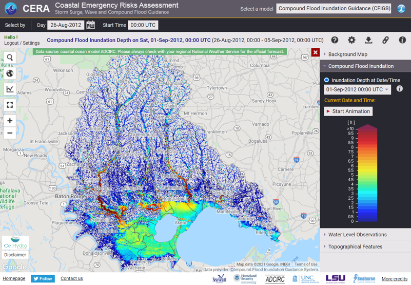
What is the Compound Flood Inundation Guidance System (CFIGS)? CFIGS is a compound flood prediction system developed at CE Hydro, capable of predicting flooding due to the combined influences of precipitation and storm surge/tidal fluctuations. It provides flood inundation guidance to promote understanding of the timing and extent of flooding before the event.
With CERA’s headquarters at the Louisiana State University (LSU), the team is excited to include this local and unique model prototype on immediate display for users to view and operate. View it here on CERA.
CFIGS was made possible with the support from Coastal Protection Restoration Authority (CPRA), Louisiana SeaGrant, Louisiana State University (LSU), Seahorse Coastal Consulting and Freese and Nichols, Inc (FNI).