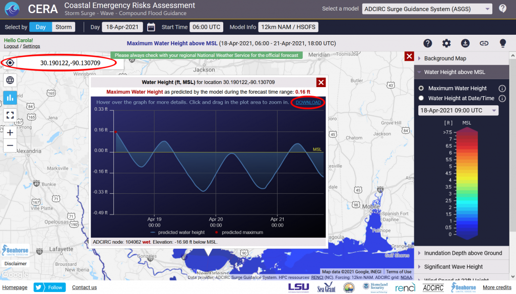
CERA visualizes time series for water levels, wind, and significant wave height for any location on the map. To use this feature, click on the time series button on the left of the map, then click on the desired location on the map.
CERA’s 2021 release now allows downloading the selected time series as a .json file. The download link is in the top right of the time series chart.
If finding a time series for a specific coordinate point is desired, click on the time series button, then click on the location search button on the left of the map. If you already have a chart open, the coordinate pair is pre-filled in the search box. If you would like to find another place, enter the coordinate as [latitude, longitude]. CERA will open the time series chart automatically.


