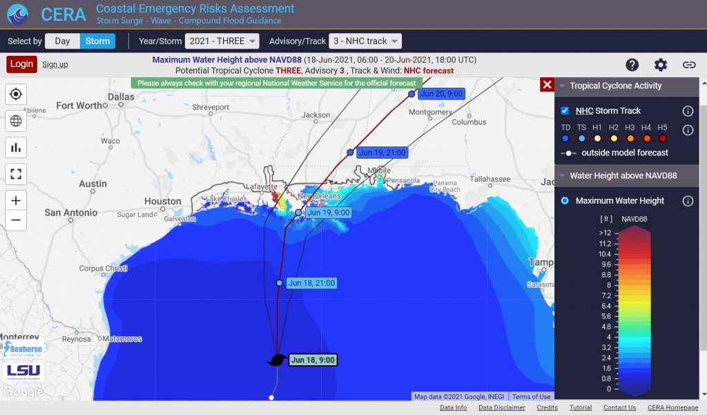
Tropical Storm Claudette (17 June – 21 June , 2021) was already the third named storm of the 2021 Atlantic hurricane season but the first tropical system that targeted both the Gulf and the Atlantic coasts.
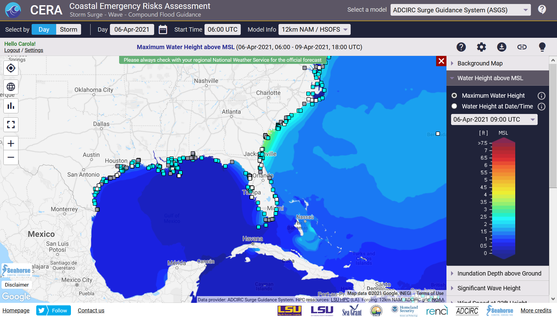
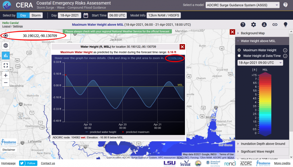
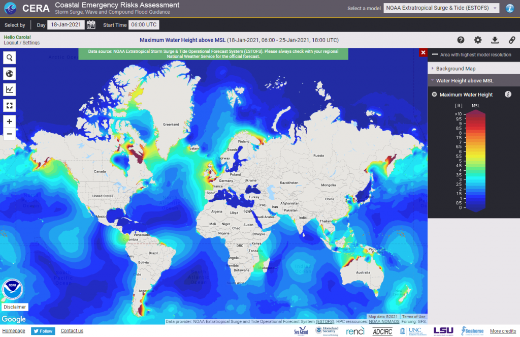
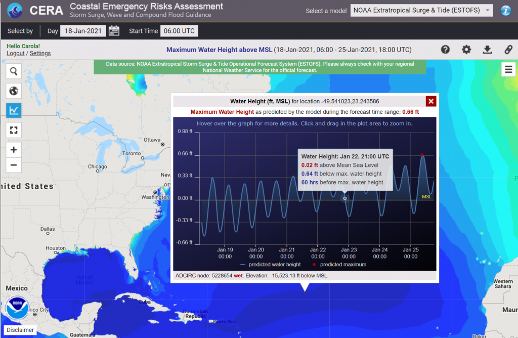
The CERA Group at the LSU Center for Computation and Technology successfully performed storm surge and flood guidance to end users in Louisiana and North Carolina. Several model results were available on the CERA website at https://cera.coastalrisk.live.
Summary:
- We used high resolution storm surge model meshes for the States of Louisiana and North Carolina and a vortex wind model to represent the NHC consensus track wind fields and the associated predicted storm surge through the ADCIRC Surge Guidance System.
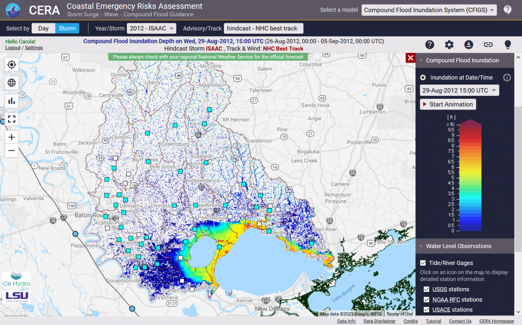
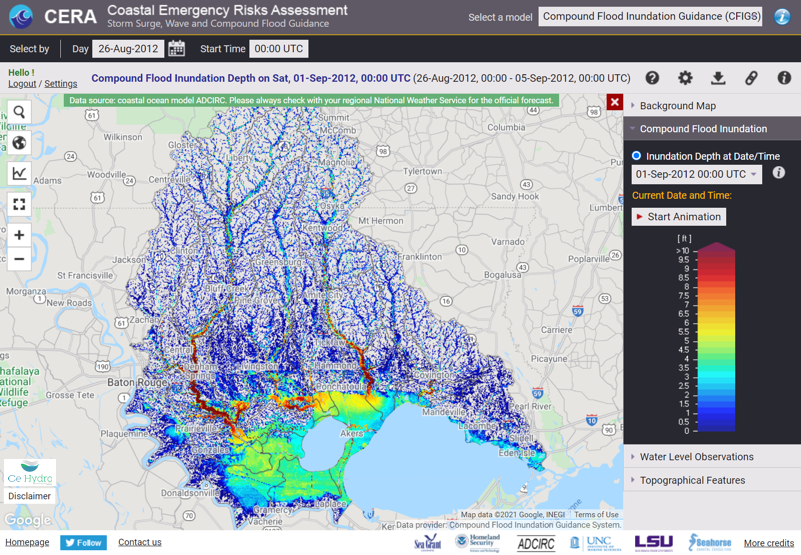
- The Compound Flood Inundation Guidance System delivered flood guidance showing compound threat predictions from surge and rainfall for watersheds in Louisiana once daily from June 16 through June 19 and an after-storm guidance on June 21.
- Customized gage stations were provided to the Louisiana Coastal Protection and Restoration Authority (CPRA) for their use to monitor water levels at critical locations.

TS Claudette impacting North Carolina, NHC advisory 15