

https://cera.coastalrisk.live/
The CERA team is happy to announce a major upgrade using the Global Extratropical Surge & Tide Operational Forecast System (ESTOFS-Global) developed by NOAA’s Office of Coast Survey. High-resolution water level forecast guidance is now provided for the entire globe.
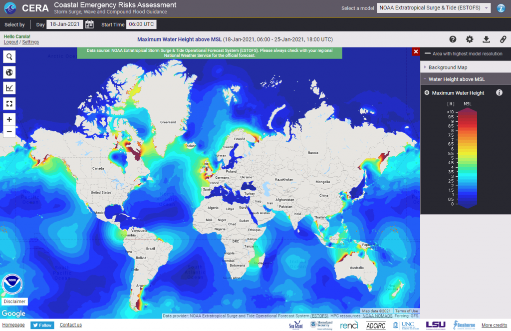
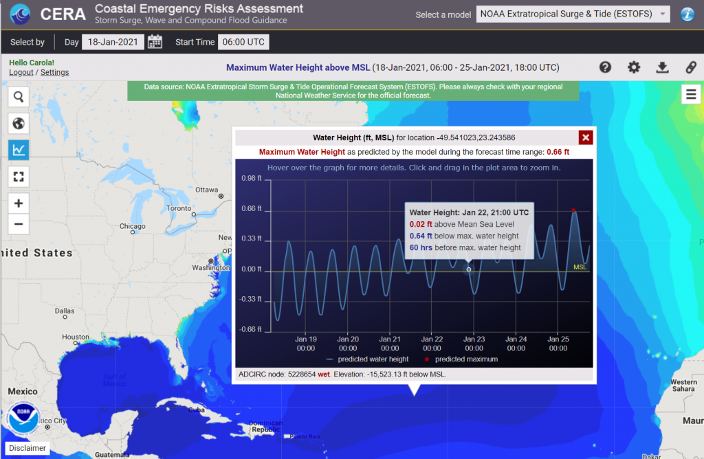
CERA provides the maximum water level height for the 06Z UTC cycle once a day. Using the CERA ‘time series’ feature displays maximum water levels at any point of interest on the map.
Unregistered users will now see the ESTOFS-Global map by default. Registered users can switch between ESTOFS-Global and customized maps from ADCIRC Surge Guidance System (ASGS) at any time using the ‘Select a model’ box at the top of the site.
You can also use the “Map Settings” option dialog at the upper right of the website to change your model preference upon opening CERA.
With this update, CERA transcends its national capability to an international level in extratropical flood forecasting using NOAA’s data.